• Welcome to the ShrimperZone forums.
    You are currently viewing our boards as a guest which only gives you limited access.

    Existing Users:.
    Please log-in using your existing username and password. If you have any problems, please see below.

    New Users:
    Join our free community now and gain access to post topics, communicate privately with other members, respond to polls, upload content and access many other special features. Registration is fast, simple and free. Click here to join.

    Fans from other clubs
    We welcome and appreciate supporters from other clubs who wish to engage in sensible discussion. Please feel free to join as above but understand that this is a moderated site and those who cannot play nicely will be quickly removed.

    Assistance Required
    For help with the registration process or accessing your account, please send a note using the Contact us link in the footer, please include your account name. We can then provide you with a new password and verification to get you on the site.

Memory Lane Southend Town Centre

AndyT

Lord of the Reedy River
Joined
Aug 7, 2010
Messages
11,974
Location
Hockley
I thought there might be a thread already of youtube clips of the town in bygone eras. but I couldn't find one.

I stumbled across the below photos of The Royals area of the high street, before The Royals was built. I used to have a mate who worked in the fish tackle shop right at the top of Pier Hill, so often popped in there. Anyway, hopefully there's a few more Southend videos to add to the below, so there's a thread of nostalgic stuff for the forum :-

 
Last edited:
Changed just a bit over the last 30 years, not necessarily for the better. Had a friend who was a waitress in Presto's cafe.
 
The Ros Southend group on FB is great for memories. Anyone know what that big old red brick house was? I don't remember it at all. We used to have our dentists above Nat West, used to go up and alley to the left of the bank and round and up some stairs there.
 
Good question on that house. Not sure myself.

I know, in the 70's there was the cinema there, The Ritz?, near the church and also some residential plots next to it, from memory.
 
Anyone know what that big old red brick house was? I don't remember it at all.

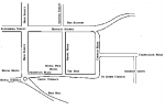
Looking at the geography of the photos, that looks like the plot that is now where Primark is, I think, so opposite where the bus station now is. There must have therefore been a road that ran through where the central walkway in The Royals is (i.e) as you enter from the bus station side of The Royals.
 
Good question on that house. Not sure myself.

I know, in the 70's there was the cinema there, The Ritz?, near the church and also some residential plots next to it, from memory.

Yes it was the Ritz. The residential plots you're talking about was probably the road going from the Ritz corner with houses both sides. It was a good short cut to get more choice of busses. I think the road was called Grove Road.
large.jpg

large.jpg
 
Last edited:
Great photos, Seventies.

Yep, that's the road I was thinking must have existed in my post above yours.

The memories are starting to come back now of that area before the demolition.
 
Looking at the film showing "The Moon Spinners" dates those photos to 1964, I think.
 
The Ritz cinema by the way was converted to a Top Rank bingo hall in the early Seventies, and later sold to become the Invicta bingo hall before closing down and empty for a few years.
 
Of course. I remember now when it was a bingo hall.

Presumably around the time The Odeon changed from a concert venue to a cinema.
 
Looking at the geography of the photos, that looks like the plot that is now where Primark is, I think, so opposite where the bus station now is. There must have therefore been a road that ran through where the central walkway in The Royals is (i.e) as you enter from the bus station side of The Royals.

1543321941912.png

http://www.southendtimeline.com/theroyals.htm
 
Perfect. Thanks, YB. :Thumbs up:

So, that house was on the corner plot of Heygate Avenue, between Grove Road and Church Road, by my reckoning.
 
Last edited:
I remember the Ritz but don't remember the road alongside it (Grove Road) at all, although I do obviously remember it being on a corner.
 
I didn't remember that road either, OBL.

I seemd to recall The Ritz was on the corner of a small almost square like area with the Palace Hotel next door.
 
Last edited:
I didn't remember that road either, OBL.

I seemd to recall The Ritz was almost on the corner of a small almost square like area with the Palace Hotel next door.

Yes.Can certainly remember delivering letters there to Motel Burstin (the owner and ex-Labour Party parliamentary candidate for Southend East ) ,when I was on the Xmas post back in the early 70's.
 
Last edited:
Yes it was the Ritz. The residential plots you're talking about was probably the road going from the Ritz corner with houses both sides. It was a good short cut to get more choice of busses. I think the road was called Grove Road.
large.jpg

large.jpg

In that bottom photo, what's that beautiful looking building facing the seafront and the other side of the road opposite The Ritz?

Looks a fantastic place.
 
It's this place, it transpires.

The Grand Pier Hotel.

Sometimes you just shouldn't demolish certain things! :Sad:

cb545532a3bb7a829d1896298c25c6a5.jpg
 
Back
Top